
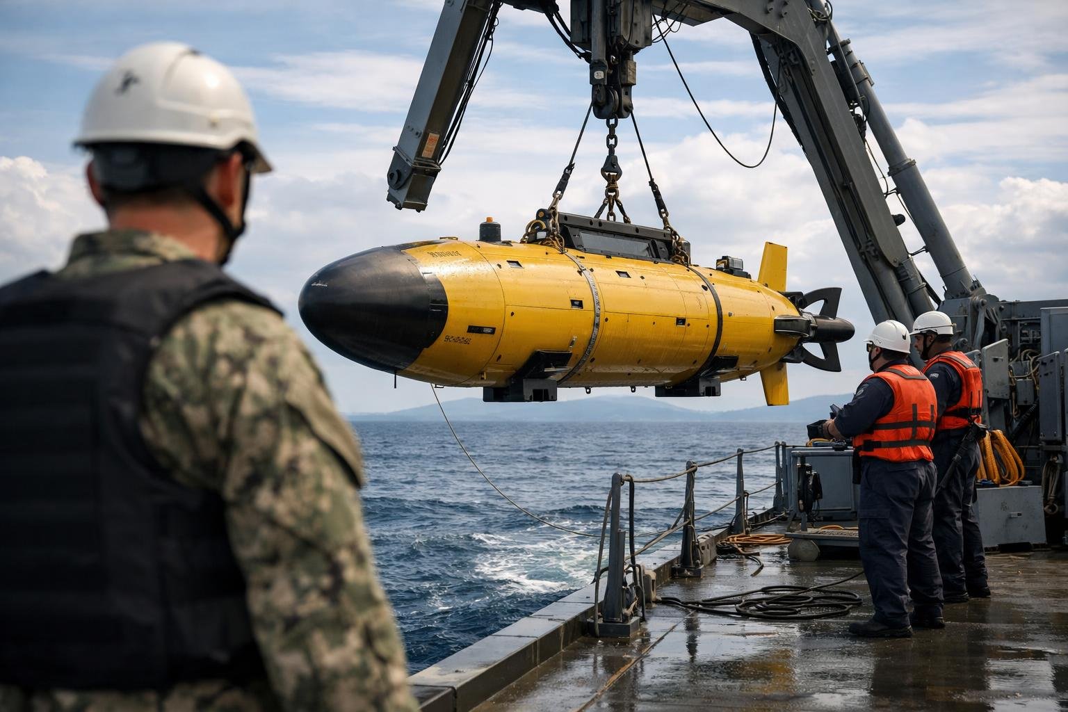
The water is unimaginably dark, the pressure is crushing, and the map is mostly blank. In those silent miles below, a new class of autonomous machine is beginning to roam, built to turn mystery into data.
Why the deep ocean still matters
Only a fraction of the seafloor is charted at high resolution, leaving vast abysses effectively unmeasured and strategically opaque. The drive to fill those gaps blends pure science with hard security calculus, from safer undersea infrastructure to better climate models. “If you want to understand the planet, you start at the bottom,” said one project engineer, noting that the seabed is both archive and engine of Earth systems.
A machine for the hadal frontier
The uncrewed craft now under test is designed for dives beyond 19,700 feet (about 6,000 meters), a zone where pressure exceeds 600 times atmospheric. Engineers speak of a minimalist, pressure-resilient architecture: a streamlined hull; internal modules isolated within titanium or ceramic spheres; and hydrodynamics tuned to stay stable in slow, precise survey passes. “Depth changes everything,” an oceanographer said. “Your materials, your power, and even your assumptions about navigation.”
Brains, sensors, and silence
To map at the edge of the world, the vehicle relies on high-end inertial navigation paired with Doppler velocity logs, plus sparse acoustic updates from seabed beacons when available. The result is autonomy that can survive the radio blackout of deep water, making route decisions and sensor prioritization on the fly. Its mapping suite centers on multi-beam echosounders, side-scan sonar, and water-column sensors, tuned to low-noise, low-drag integration. Engineers describe a philosophy of “measure once, measure well,” trading top speed for exquisite acoustic clarity.
Power that endures pressure
At these depths, every watt is precious. The vehicle’s design hints at modular battery bays, thermal management that sips heat, and careful payload scheduling to stretch endurance from a single day to many tens of hours. The mantra is efficiency—smart dive planning, quiet propulsion, and algorithms that skip empty water and focus on targets. “We don’t want a sprinter; we want a marathoner,” a test lead said, underscoring the shift from short sorties to persistent presence.
Mapping with purpose
Beyond pretty bathymetric pictures, the payoff is actionable context. High-resolution seafloor maps de-risk cable routes, guide habitat protection, and reveal geohazards hidden under drifts of fine sediment. Water-column data can locate methane seeps, pinpoint upwellings, and capture signs of changing chemistry. In contested waters, detailed terrain models can turn a chaotic landscape into navigational advantage, compressing planning cycles from weeks to hours.
Claimed firsts, careful framing
Program officials have described the effort as a world first, though deep-capable autonomous systems exist in research and commercial fleets. What sets this platform apart, they argue, is the blend of operational depth, fully autonomous mapping, and military-grade endurance. If delivered as advertised, it would mark a new tier of reliable, repeatable deep operations—not a one-off stunt, but a scalable system.
How it talks when nothing carries
Because radio waves die quickly in seawater, the craft relies on acoustic bursts, preplanned scripts, and post-mission data offload. In routine runs, it may surface to push gigabytes by satellite; in stealthier profiles, it stores raw and transmits summaries or alerts. Fail-safes matter: timed ascent routines, drop-weights for emergency buoyancy, and geo-fenced behaviors if navigation drifts.
Risks, rules, and responsibility
Any deep robotic presence raises scientific, legal, and environmental questions. Engineers emphasize low-acoustic signatures to minimize harm to marine life, transparent data-sharing where possible, and compliance with international law when operating near sensitive areas. “Exploration and protection can reinforce each other,” a policy advisor said, pointing to corridors where detailed charts reduce collision and cable damage.
What success looks like
In the near term, success is a repeatable cycle: deploy, dive, map, and recover—with minimal ship time and maximal data quality. Over time, a fleet could assemble seafloor mosaics once thought impossible, knitting local surveys into global baselines. That dataset would sharpen forecasting, enrich marine reserves planning, and offer industry a clearer picture of what lies beneath.
- Expected benefits include safer subsea infrastructure, richer climate datasets, improved habitat mapping, and reduced ship time through persistent, autonomous deep survey.
The bigger arc
Autonomy has transformed the air, then the land, and now the sea’s deepest rooms are opening. Each dive writes a few more lines in a language the planet has kept hidden, converting pressure and darkness into pixels and points. “The deep was once a blank page,” an engineer mused, “and we’re finally learning how to read it.” If this program stays on track, the most remote places on Earth could soon be the best understood, turning absence of knowledge into a strategic and scientific asset.