
El Niño could return later this year and increase the likelihood of rain in Southeast Texas, but decades of data do not show a consistent increase in hail, tornadoes, or damaging winds in Houston.
The possible return of El Niño later this year has raised a common question in Texas: if this climate pattern brings more storms, does it also mean more hail and severe weather?
An analysis of nearly three decades of meteorological data indicates the answer is no. While El Niño tends to favor more rainfall events and a wetter pattern in Southeast Texas, it has not shown a consistent relationship with more hail, tornadoes, or damaging winds.
Between 1992 and 2019, Southeast Texas recorded a very similar average annual number of severe weather events in years with El Niño and years without that pattern. The region averaged about 156 severe events in El Niño years, compared with 155 in other years.
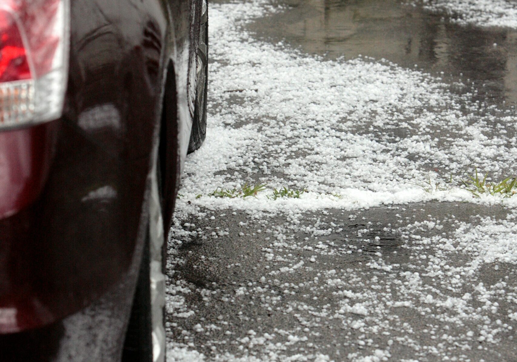
The difference is much clearer when looking at flash flood events. In that same period, El Niño years averaged around 45 flash flood events per year in Southeast Texas, compared to about 36 in other years. That increase is about 20%.
More Storms Do Not Automatically Mean More Hail
El Niño occurs when sea surface temperatures in the equatorial Pacific rise above average. That warming can shift the jet stream southward and steer more storm systems toward the southern United States.
In Texas, that pattern usually translates into more opportunities for rain, especially during the cooler months. For Houston and Southeast Texas, that can mean more cloudy days, more active fronts, and more episodes of precipitation.
But severe storms require a more precise combination of ingredients. Hail, tornadoes, and damaging winds depend on factors such as atmospheric instability, wind shear, available moisture, and local boundaries like sea breezes or convergence zones.
Those ingredients can change from one storm to another and from year to year. Although El Niño brings more moisture and more storm systems to the region, it does not guarantee that conditions will organize sufficiently to produce large hail or tornadoes.
Flooding Shows a Stronger Signal During El Niño
The most consistent link between El Niño and Southeast Texas climate appears in rainfall.
During the El Niño years analyzed between 1992 and 2019, flash flood events were more frequent than in other years. The difference is explained by how El Niño can enhance moisture and guide storms toward the Gulf Coast.
Flooding does not require the same atmospheric structure as hail or tornadoes. A storm can produce heavy rain for several hours without necessarily turning into a severe storm with large hail or damaging winds.
In Houston, that difference is relevant because the risks of heavy rain and flooding tend to depend as much on the atmospheric pattern as on local drainage capacity, soil saturation, and the speed with which storms move.
The Data Do Not Show a Clear Increase in Hail, Tornadoes, or Damaging Winds
The analysis of data from 1992 to 2019 found little measurable variation in overall severe activity during El Niño years in Southeast Texas.
That tally includes hail, tornadoes, and damaging winds. None of these categories showed a consistent change directly associated with El Niño in the region.
Nationally, some studies have found that La Niña may favor configurations more conducive to severe weather, especially in the central plains and the Southeast United States. On the Gulf Coast, those broad patterns do not always translate directly.
Southeast Texas has its own dynamics. The abundant humidity of the Gulf of Mexico, coastal breezes, fronts that arrive weakened, and local boundaries can strongly influence how storms form and strengthen.
The Season of the Year Weighs More Than the Pacific Pattern
In Houston and Southeast Texas, the time of year remains the more important factor for the risk of hail and damaging winds.
Spring is the most active period for these events, driven by the rise in atmospheric instability and the more frequent arrival of storm systems. That combination tends to create better conditions for strong or severe storms.
Tornado activity has two windows of higher risk in the region: spring and autumn. The second uptick occurs when seasonal changes once again favor temperature contrasts, humidity, and atmospheric movement.
These seasonal cycles tend to carry more weight for the local risk of severe weather than the presence of El Niño or La Niña in the Pacific.
Recent Years Show How Irregular Severe Weather Can Be
Recent years have shown that severe activity can concentrate in specific bursts and not be spread evenly.
In 2025, the United States recorded 1,559 tornadoes, one of the most active years in recent records and well above the average. Much of that activity was concentrated in several major spring outbreaks, many of them outside Texas.
That concentration highlights a limitation of large-scale climate patterns. El Niño can modify overall probabilities, but it does not control precisely where or when individual outbreaks of severe weather occur.
For Southeast Texas, local conditions remain determinative. A mass of moist air, a well-placed storm boundary, or a sea breeze can change storm behavior in a matter of hours.
The Pacific Remains Neutral, but Could Change This Year
For now, the Pacific is expected to stay in a neutral phase for much of the summer. However, a large reservoir of warm water beneath the surface could help the development of El Niño later this year.
If that warming strengthens during the fall or winter, Texas could see a more active storm track across the southern United States and a higher probability of wet weather.
El Niño’s influence on the hurricane season will depend on the timing of its development. This pattern tends to increase wind shear over the Atlantic, which can hinder the formation or intensification of tropical storms. If El Niño appears late, that effect could be limited.
Houston Could See More Rain If El Niño Strengthens
For Houston, the most consistent scenario associated with El Niño is a higher risk of rain and flooding events, not an automatic rise in hail or tornadoes.
Available data show that severe events in Southeast Texas remain relatively stable between years with El Niño and years without El Niño. Heavy rainfall, by contrast, does show a more pronounced signal.
Spring will continue to be the main period for hail and damaging winds in the region, while autumn maintains a second window of risk for tornadoes. If El Niño solidifies toward the end of the year, the most likely change for Southeast Texas would be a wetter pattern during the cooler months.