
The 2026 regional map classifies ZIP codes into Coastal Zone, Zone A, Zone B, or Zone C, and shows the designated roads to exit areas exposed to storm surge.
The Atlantic hurricane season is approaching its peak in statistical activity, which occurs around September 10. For residents of Houston and Harris County, this period allows checking whether a home is located within an evacuation zone and identifying in advance the designated road to exit the area.
The onset of the seasonal peak does not by itself trigger an evacuation. Authorities issue instructions for specific ZIP codes when a storm threatens the region and the forecast indicates a risk of storm surge. Those who do not receive an order should prepare to shelter in a safe place and stay alert to local alerts.
September 10 marks the Atlantic hurricane peak in statistical activity
Tropical activity in the Atlantic typically reaches its maximum around September 10, although the greatest concentration of storms occurs between mid-August and mid-October. The season remains officially open until November 30.
The climatological peak does not predict that a hurricane will reach Houston on a specific date. It also does not indicate the trajectory, intensity, or entry point of a future storm. It is a historical measure of when more cyclones form across the Atlantic basin.
NoAA maintains for 2026 a forecast of below-average activity, but that calculation does not determine the risk of impact in a city. The difference between overall activity and local impacts is explained in the related note about the 2026 hurricane forecast and Houston’s risk.
The 2026 hurricane map classifies zones by storm surge risk
The regional hurricane system divides exposed areas into four categories: Coastal Zone, Zone A, Zone B, and Zone C. These designations are based on storm surge risk and do not correspond to FEMA’s overall flood-inundation map.
Authorities use the forecast height and extent of the surge to decide which zones should evacuate. An order may cover only part of the region, so appearing on the map does not mean a home must be evacuated for every storm.
Not all ZIP codes in Houston or Harris County belong to an evacuation zone. Additionally, some codes are split between north and south, identified with the letters “n” and “s.” ZIP code 77058, for example, appears split into two zones, so it is not enough to check only the five digits.
Harris County allows checking the zone with an address
Residents of Harris County can use the interactive evacuation zones map to locate a home. The tool allows searching for an address and checking whether it lies within a designated zone.
The regional guide in Spanish from H-GAC is also available, which brings together the ZIP code map, the routes map, and the 2026 preparedness materials.
To perform the query:
- Enter the full address in the Harris County interactive map.
- Confirm whether the property appears in the Coastal Zone, Zone A, B, or C.
- Check whether the ZIP code has a north or south division.
- Save a copy of the regional evacuation routes map.
- Identify more than one road to reach the inland destination.
The designated routes lead inland within Texas
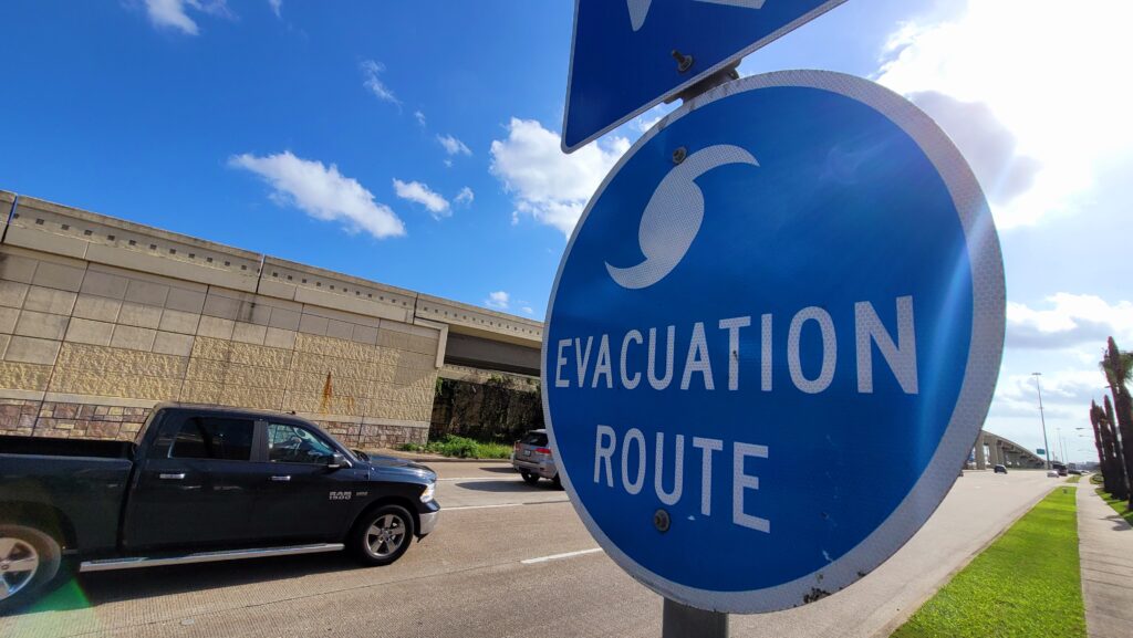
Evacuation routes are roads designated to move traffic from coastal areas and low-lying areas toward safer inland locations. Texas identifies them with blue circular signs showing the white silhouette of a hurricane and an arrow indicating the travel direction.
The regional map includes major highways and roads in the Houston-Galveston area. However, the best route can change depending on the origin of the evacuation, current traffic conditions, closures, and the instructions issued for each storm.
TxDOT may enable additional lanes or contraflow during a large-scale evacuation. Those operations should only be used when activated and signed. Drivers can check closures, congestion, and road conditions on DriveTexas before departing.
Evacuating before the call can increase congestion
evacuations are carried out in stages to allow the areas with greater exposure to exit first. Leaving the area before a zone is called can saturate roads, fueling stations, and accommodations needed by those facing the most immediate danger.
When a hurricane evacuation order is issued for a given zone, residents should depart without waiting until the last moment and follow the route and schedule indicated by authorities. The instructions may distinguish between voluntary evacuation, mandatory evacuation, and shelter-in-place.
People living outside surge zones should prepare to shelter in place unless a local authority orders otherwise. A home outside the map can still face rain, flooding, wind, tornadoes, or power outages.
2-1-1 registers residents who may need assistance after a hurricane.
People with disabilities, medical needs, or transportation limitations can register in the State of Texas Emergency Assistance Registry, known as STEAR. The registry is available online or by calling 2-1-1, and it allows emergency responders to know the existing needs in their jurisdiction.
ReadyHarris also offers weather and emergency alerts for Harris County. During the 2026 season, residents can text the word GULF2026 to 888777 to receive updates via text message.
The regional maps of zones and routes remain in effect for 2026, but a hurricane evacuation will always depend on the specific order issued for each storm and each jurisdiction.