
NOAA Anticipates a 2026 Atlantic Hurricane Season with Less Activity Than Usual, While Keeping the Call for Preparedness in Coastal Areas and Communities Exposed to Tropical Storms
The federal forecast estimates between 8 and 14 named storms, 3 to 6 hurricanes, and 1 to 3 major hurricanes, category 3 or higher. The Atlantic season begins on June 1 and runs through November 30.
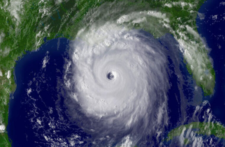
The federal forecast points to fewer storms in the Atlantic
The National Oceanic and Atmospheric Administration (NOAA) projects a 55% probability that the season will be below normal, a 35% chance of near-average activity, and a 10% chance of above-average activity.
The forecasted range includes storms with winds of at least 39 mph, hurricanes with winds of 74 mph or more, and major hurricanes with winds of at least 111 mph.
The reference Atlantic average, based on the 1991-2020 period, is 14 named storms, 7 hurricanes, and 3 major hurricanes. This year’s forecast sits below those values, though it does not eliminate the risk of local impacts.
For Houston and other parts of Texas, the forecast does not indicate how many storms could make landfall or which specific areas could be affected. NOAA notes that tracks, timing, and intensity of impacts depend on daily weather patterns that cannot be anticipated with months of lead time.
El Niño could limit storm formation
NOAA’s forecast takes into account several atmospheric and oceanic factors. One of the primary factors is the likelihood of El Niño conditions during the season.
El Niño tends to increase vertical wind shear in the Atlantic. That pattern makes it harder for tropical waves to organize, strengthen, and develop into storms or hurricanes.
NOAA data indicate a high probability of El Niño conditions during the months of greatest activity. It is also anticipated that the phenomenon could reach moderate intensity or stronger during the August–October period, when the bulk of Atlantic tropical activity typically concentrates.
Still, the Atlantic remains within a high-activity phase that began in 1995. NOAA considers that some elements of that pattern will remain in 2026, such as warmer sea temperatures and weaker trade winds in certain areas, though with less strength than in recent seasons.
The season begins on June 1 and ends on November 30
The Atlantic hurricane season officially starts on June 1 and ends on November 30. The National Hurricane Center maintains vigilance over the Atlantic, the Caribbean, and the Gulf during that period, with updates when tropical systems form or conditions for development exist.
As of May 22, there were no active tropical cyclones in the Atlantic, according to the National Hurricane Center. The season had not formally begun yet, but weather monitoring remains in place as June approaches.
NOAA will update its forecast in August, as the months of peak activity approach. In the Atlantic, tropical activity typically increases in August, September, and October.
For residents of the Houston area, that window coincides with a period when heavy rains and tropical systems can cause flooding, service interruptions, road closures, and impacts on homes or businesses, even if a storm does not enter directly through the city.
Flood Alert in Houston Will Remain Active During Memorial Day Weekend
A Less Active Year Does Not Eliminate Risk for the Texas Coast
A season below average can still feature fewer storms, but a single one can cause significant damage if it nears land or rapidly intensifies.
NOAA cautions that the seasonal forecast measures overall activity in the Atlantic basin, not impacts by city, county, or state. A year with few storms can have serious consequences if one of those systems affects a populated or vulnerable area.
In the Houston area, preparedness typically includes reviewing insurance policies, important documents, supplies for several days, medications, batteries, water, non-perishable foods, and family communication plans.
It is also wise to identify evacuation routes, review local alerts, and know whether the home is in a flood-prone area. In communities with seniors, people with disabilities, or families without private transportation, these plans may require more time.
Preparation Should Be Reviewed Before an Active Alert Is Issued
The National Weather Service and the National Hurricane Center issue watches and warnings when a system poses a risk to land. In 2026, the National Hurricane Center also incorporated improvements to its graphical products, including a track cone that can display tropical storm and hurricane alerts for inland areas.
That update aims to better reflect wind risks beyond the coast. In recent storms, inland communities have faced damage from gusts, heavy rains, and rapid flooding after systems advance on shore.
Residents can consult official updates from the National Weather Service, the National Hurricane Center, and local emergency management authorities during the season.
NOAA’s forecast for 2026 places the Atlantic below average, with 8 to 14 named storms, 3 to 6 hurricanes, and up to 3 major hurricanes. The season will run from June 1 to November 30.